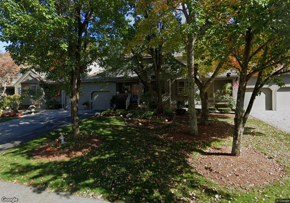
96 Highbank Rd Franklin, MA 02038
Estimated Value: $590,000 - $609,000
2
Beds
3
Baths
1,873
Sq Ft
$321/Sq Ft
Est. Value
About This Home
This home is located at 96 Highbank Rd, Franklin, MA 02038 and is currently estimated at $600,589, approximately $320 per square foot. 96 Highbank Rd is a home located in Norfolk County with nearby schools including Gerald M. Parmenter Elementary School, Remington Middle School, and Franklin High School.
Ownership History
Date
Name
Owned For
Owner Type
Purchase Details
Closed on
Jul 8, 2020
Sold by
Faretra Robert J and Faretra Christine M
Bought by
Faretra Ft
Current Estimated Value
Home Financials for this Owner
Home Financials are based on the most recent Mortgage that was taken out on this home.
Original Mortgage
$280,395
Outstanding Balance
$250,896
Interest Rate
3.6%
Mortgage Type
New Conventional
Estimated Equity
$349,693
Purchase Details
Closed on
Apr 8, 2013
Sold by
Faretra Robert J and Faretra Christine M
Bought by
Faretra Ft and Faretra Robert J
Home Financials for this Owner
Home Financials are based on the most recent Mortgage that was taken out on this home.
Original Mortgage
$320,751
Interest Rate
3.58%
Mortgage Type
New Conventional
Purchase Details
Closed on
Oct 31, 2006
Sold by
Faretra Robert J and Faretra Christine M
Bought by
Faretra Ft and Faretra Robert J
Purchase Details
Closed on
Jun 16, 2006
Sold by
Godin Kathryn R and Godin William C
Bought by
Faretra Christine M and Faretra Robert J
Home Financials for this Owner
Home Financials are based on the most recent Mortgage that was taken out on this home.
Original Mortgage
$278,000
Interest Rate
6.62%
Mortgage Type
Purchase Money Mortgage
Purchase Details
Closed on
Oct 8, 1999
Sold by
Carlson Margaret M
Bought by
Godin William C and Godin Kathryn R
Home Financials for this Owner
Home Financials are based on the most recent Mortgage that was taken out on this home.
Original Mortgage
$160,000
Interest Rate
7.81%
Mortgage Type
Purchase Money Mortgage
Purchase Details
Closed on
May 21, 1993
Sold by
Andersen Craig O and Andersen Donna M
Bought by
Carlson Margaret M
Home Financials for this Owner
Home Financials are based on the most recent Mortgage that was taken out on this home.
Original Mortgage
$50,000
Interest Rate
7.54%
Mortgage Type
Purchase Money Mortgage
Create a Home Valuation Report for This Property
The Home Valuation Report is an in-depth analysis detailing your home's value as well as a comparison with similar homes in the area
Home Values in the Area
Average Home Value in this Area
Purchase History
| Date | Buyer | Sale Price | Title Company |
|---|---|---|---|
| Faretra Ft | -- | None Available | |
| Faretra Robert J | -- | None Available | |
| Faretra Ft | -- | -- | |
| Faretra Ft | -- | -- | |
| Faretra Christine M | $347,500 | -- | |
| Godin William C | $200,000 | -- | |
| Carlson Margaret M | $149,900 | -- |
Source: Public Records
Mortgage History
| Date | Status | Borrower | Loan Amount |
|---|---|---|---|
| Open | Faretra Robert J | $280,395 | |
| Previous Owner | Faretra Ft | $320,751 | |
| Previous Owner | Carlson Margaret M | $287,500 | |
| Previous Owner | Faretra Christine M | $278,000 | |
| Previous Owner | Faretra Christine M | $34,700 | |
| Previous Owner | Carlson Margaret M | $160,000 | |
| Previous Owner | Carlson Margaret M | $50,000 |
Source: Public Records
Tax History Compared to Growth
Tax History
| Year | Tax Paid | Tax Assessment Tax Assessment Total Assessment is a certain percentage of the fair market value that is determined by local assessors to be the total taxable value of land and additions on the property. | Land | Improvement |
|---|---|---|---|---|
| 2025 | $6,099 | $524,900 | $0 | $524,900 |
| 2024 | $5,976 | $506,900 | $0 | $506,900 |
| 2023 | $5,652 | $449,300 | $0 | $449,300 |
| 2022 | $5,614 | $399,600 | $0 | $399,600 |
| 2021 | $5,352 | $365,300 | $0 | $365,300 |
| 2020 | $4,928 | $339,600 | $0 | $339,600 |
| 2019 | $4,899 | $334,200 | $0 | $334,200 |
| 2018 | $4,506 | $307,600 | $0 | $307,600 |
| 2017 | $4,319 | $296,200 | $0 | $296,200 |
| 2016 | $4,443 | $306,400 | $0 | $306,400 |
| 2015 | $4,448 | $299,700 | $0 | $299,700 |
| 2014 | $3,695 | $255,700 | $0 | $255,700 |
Source: Public Records
Map
Nearby Homes
- 57 Bayberry Common Unit 57
- 25 Spruce Pond Rd
- 0 Fall Ln
- 55 Lawrence Dr Unit 55
- 29 Lawrence Dr
- 40 Lawrence Dr Unit 40
- 6 Woodchester Rd
- 254 Summer St
- 15 Ribero Dr
- 417 Union St
- 82 Uncas Ave Unit 1
- 62 Wachusett St
- 374-378 Union St
- 1 Pond Place
- 246 Washington St
- 1 Joy St
- 32 Dale St
- 99 Summer St
- 62 Uncas Ave
- 40 Cross St
- 95 Highbank Rd
- 95 Highbank Rd Unit 95
- 95 Highbank Rd Unit 95 27
- 91 Highbank Rd Unit 91
- 94 Highbank Rd
- 93 Highbank Rd
- 92 Highbank Rd
- 91 Highbank Rd
- 91 Highbank Rd Unit 91 25-26
- 91 Highbank Rd Unit 91,26
- 100 Highbank Rd
- 99 Highbank Rd
- 98 Highbank Rd
- 97 Highbank Rd
- 98 Highbank Rd Unit 98
- 98 Highbank Rd Unit 98,1
- 99 Highbank Rd Unit 99
- 90 Highbank Rd
- 89 Highbank Rd
- 17 Lockewood Dr