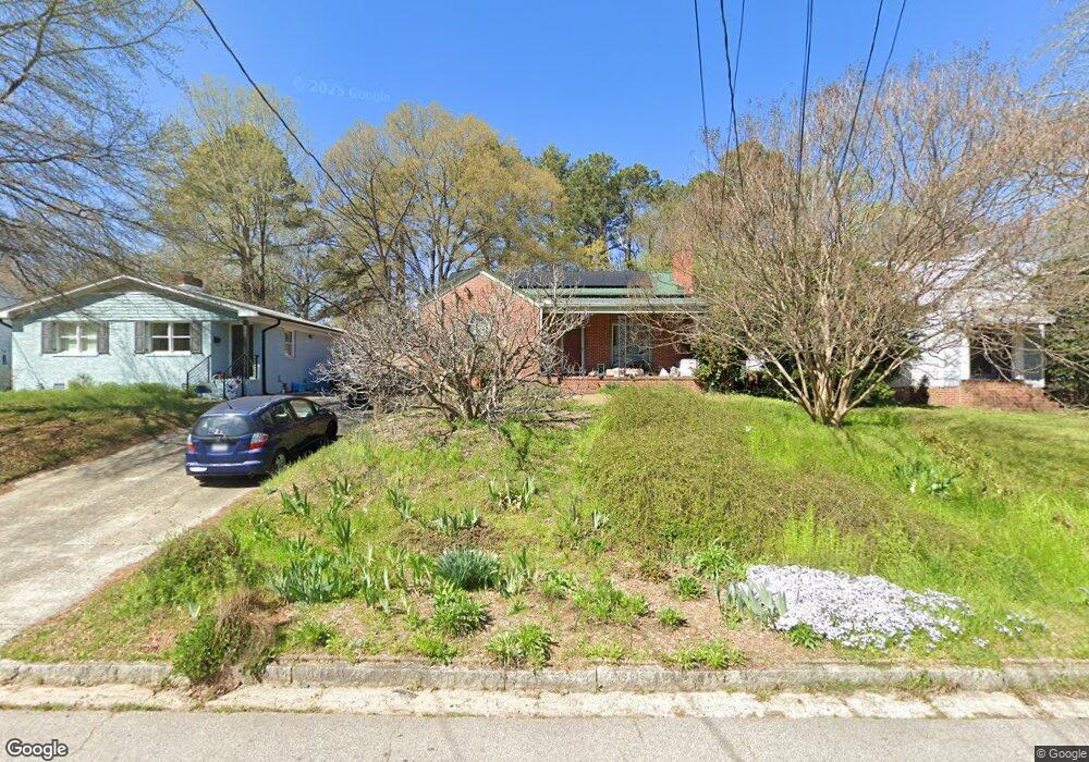
109 E Maynard Ave Durham, NC 27704
Northgate Park NeighborhoodEstimated Value: $377,000 - $404,000
3
Beds
1
Bath
1,325
Sq Ft
$295/Sq Ft
Est. Value
About This Home
This home is located at 109 E Maynard Ave, Durham, NC 27704 and is currently estimated at $391,386, approximately $295 per square foot. 109 E Maynard Ave is a home located in Durham County with nearby schools including W.G. Pearson Elementary School, Club Boulevard Elementary School, and Brogden Middle.
Ownership History
Date
Name
Owned For
Owner Type
Purchase Details
Closed on
Oct 3, 2012
Sold by
Mitchell Jack H and Cray Rebecca E
Bought by
Mitchell Jack H and Cary Rebecca E
Current Estimated Value
Purchase Details
Closed on
Mar 14, 2005
Sold by
Gee Lura Larson and Gee Timothy W
Bought by
Mitchell Jack H
Home Financials for this Owner
Home Financials are based on the most recent Mortgage that was taken out on this home.
Original Mortgage
$108,000
Interest Rate
5.6%
Mortgage Type
Purchase Money Mortgage
Create a Home Valuation Report for This Property
The Home Valuation Report is an in-depth analysis detailing your home's value as well as a comparison with similar homes in the area
Home Values in the Area
Average Home Value in this Area
Purchase History
| Date | Buyer | Sale Price | Title Company |
|---|---|---|---|
| Mitchell Jack H | -- | None Available | |
| Mitchell Jack H | $135,000 | -- |
Source: Public Records
Mortgage History
| Date | Status | Borrower | Loan Amount |
|---|---|---|---|
| Previous Owner | Mitchell Jack H | $108,000 |
Source: Public Records
Tax History
| Year | Tax Paid | Tax Assessment Tax Assessment Total Assessment is a certain percentage of the fair market value that is determined by local assessors to be the total taxable value of land and additions on the property. | Land | Improvement |
|---|---|---|---|---|
| 2025 | $3,776 | $380,954 | $184,500 | $196,454 |
| 2024 | $3,083 | $221,033 | $30,750 | $190,283 |
| 2023 | $2,895 | $221,033 | $30,750 | $190,283 |
| 2022 | $2,829 | $221,033 | $30,750 | $190,283 |
| 2021 | $2,816 | $221,033 | $30,750 | $190,283 |
| 2020 | $2,750 | $221,110 | $30,750 | $190,360 |
| 2019 | $2,750 | $221,110 | $30,750 | $190,360 |
| 2018 | $1,923 | $141,775 | $27,675 | $114,100 |
| 2017 | $1,909 | $141,775 | $27,675 | $114,100 |
| 2016 | $1,845 | $141,775 | $27,675 | $114,100 |
| 2015 | $1,977 | $142,798 | $25,408 | $117,390 |
| 2014 | $1,977 | $142,798 | $25,408 | $117,390 |
Source: Public Records
Map
Nearby Homes
- 2707 N Roxboro St
- 111 W Murray Ave
- 213 Gresham Ave
- 217 Gresham Ave
- 304 E Hammond St
- 209 E Lavender Ave
- 313 W Murray Ave
- 317 W Murray Ave
- 611 E Lavender Ave
- 312 Greenwood Dr
- 2504 Shenandoah Ave
- 410 W Maynard Ave
- 617 E Maynard Ave
- 2421 Banner St
- 621 Bon Air Ave
- 2402 Shenandoah Ave
- 3001 Corinth Ln
- 621 Hugo St
- 701 E Lavender Ave
- 2412 Cascadilla St
- 107 E Maynard Ave
- 111 E Maynard Ave
- 105 E Maynard Ave
- 113 E Maynard Ave
- 103 E Maynard Ave
- 115 E Maynard Ave
- 2806 Farthing St
- 117 E Maynard Ave
- 101 E Maynard Ave
- 106 E Edgewood Dr
- 108 E Edgewood Dr
- 104 E Edgewood Dr
- 108 E Maynard Ave
- 110 E Maynard Ave
- 102 E Edgewood Dr
- 104 E Maynard Ave
- 112 E Maynard Ave
- 106 E Maynard Ave
- 110 E Edgewood Dr
- 102 E Maynard Ave
Your Personal Tour Guide
Ask me questions while you tour the home.