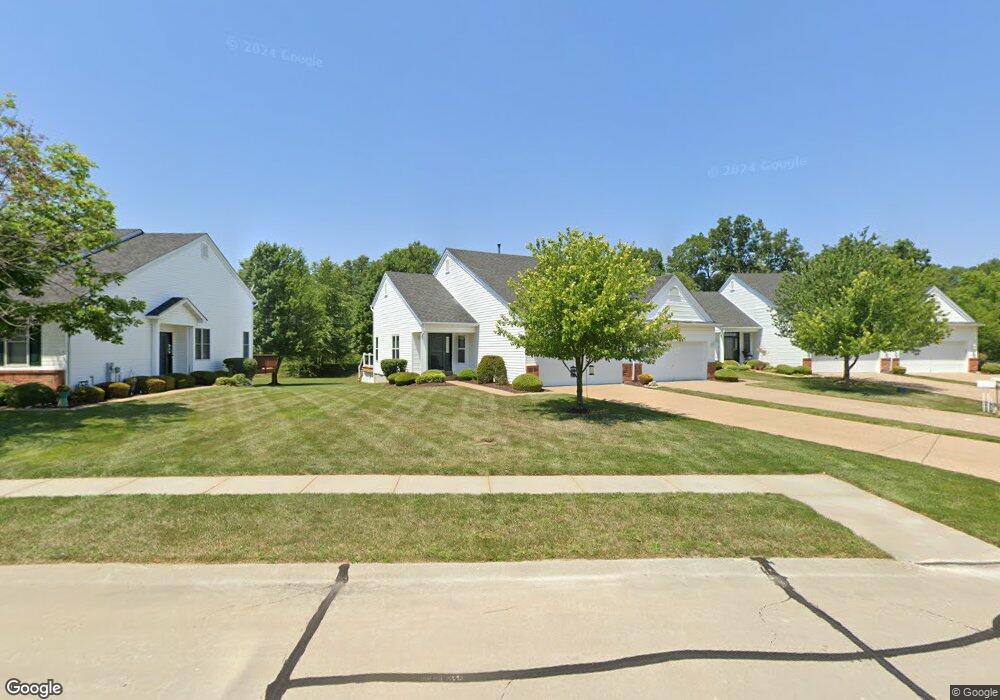
1634 Thurston Ct O Fallon, MO 63366
Estimated Value: $253,000 - $271,000
2
Beds
2
Baths
1,074
Sq Ft
$247/Sq Ft
Est. Value
About This Home
This home is located at 1634 Thurston Ct, O Fallon, MO 63366 and is currently estimated at $264,899, approximately $246 per square foot. 1634 Thurston Ct is a home located in St. Charles County with nearby schools including Westhoff Elementary School, Fort Zumwalt North Middle School, and Fort Zumwalt North High School.
Ownership History
Date
Name
Owned For
Owner Type
Purchase Details
Closed on
Jan 12, 2012
Sold by
Fannie Mae
Bought by
Schiller Judith K
Current Estimated Value
Purchase Details
Closed on
Sep 14, 2011
Sold by
Mosey Pamela M
Bought by
Federal National Mortgage Association
Purchase Details
Closed on
Oct 31, 2003
Sold by
Deubel Brian R
Bought by
Mosey Pamela
Home Financials for this Owner
Home Financials are based on the most recent Mortgage that was taken out on this home.
Original Mortgage
$112,000
Interest Rate
5.96%
Mortgage Type
Purchase Money Mortgage
Purchase Details
Closed on
Jun 13, 2002
Sold by
Whittaker Builders Inc
Bought by
Deubel Brian R
Home Financials for this Owner
Home Financials are based on the most recent Mortgage that was taken out on this home.
Original Mortgage
$98,850
Interest Rate
6.12%
Create a Home Valuation Report for This Property
The Home Valuation Report is an in-depth analysis detailing your home's value as well as a comparison with similar homes in the area
Home Values in the Area
Average Home Value in this Area
Purchase History
| Date | Buyer | Sale Price | Title Company |
|---|---|---|---|
| Schiller Judith K | $90,500 | None Available | |
| Federal National Mortgage Association | $112,144 | None Available | |
| Mosey Pamela | -- | -- | |
| Deubel Brian R | -- | -- |
Source: Public Records
Mortgage History
| Date | Status | Borrower | Loan Amount |
|---|---|---|---|
| Previous Owner | Mosey Pamela | $112,000 | |
| Previous Owner | Deubel Brian R | $98,850 |
Source: Public Records
Tax History
| Year | Tax Paid | Tax Assessment Tax Assessment Total Assessment is a certain percentage of the fair market value that is determined by local assessors to be the total taxable value of land and additions on the property. | Land | Improvement |
|---|---|---|---|---|
| 2025 | $2,604 | $43,712 | -- | -- |
| 2024 | $2,604 | $39,153 | -- | -- |
| 2023 | $2,605 | $39,153 | -- | -- |
| 2022 | $2,264 | $31,592 | $0 | $0 |
| 2021 | $2,265 | $31,592 | $0 | $0 |
| 2020 | $2,128 | $28,787 | $0 | $0 |
| 2019 | $2,133 | $28,787 | $0 | $0 |
| 2018 | $2,000 | $25,766 | $0 | $0 |
| 2017 | $1,967 | $25,766 | $0 | $0 |
| 2016 | $1,761 | $22,962 | $0 | $0 |
| 2015 | $1,637 | $22,962 | $0 | $0 |
| 2014 | $1,688 | $23,296 | $0 | $0 |
Source: Public Records
Map
Nearby Homes
- 231 England Dr
- 487 Chatham Dr
- 765 Koch Rd
- 1020 Ashfield Ln
- 122 Courtfield Dr
- 3.59 Acres Matteson Blvd
- 7.19 Acres Matteson Blvd
- 3.6 Acres Matteson Blvd
- 1373 New Charter Ln
- 354 Highgrove Place Dr
- 730 Homerun Dr Unit 76N
- 1805 Sapling Dr
- 1806 Sapling Dr
- 6 S Boxwood Ln
- 634 Homerun Dr Unit 34N
- 632 Homerun Dr Unit 33N
- 2837 Grand Slam Dr
- 19 Homefield Gardens Dr Unit 27N
- 17 Homefield Gardens Dr
- 31 Piepers Glen Ct
- 1632 Thurston Ct
- 1636 Thurston Ct
- 1630 Thurston Ct
- 1630 Thurston Ct Unit 46A
- 1638 Thurston Ct
- 1628 Thurston Ct
- 1626 Thurston Ct
- 1624 Thurston Ct
- 1644 Thurston Ct
- 1622 Thurston Ct
- 1620 Thurston Ct
- 1646 Thurston Ct
- 1648 Thurston Ct
- 1650 Thurston Ct
- 1650 Thurston Ct Unit 42A
- 1652 Thurston Ct
- 201 Shinstock Ln
- 1654 Thurston Ct
- 167 Maryland Dr
- 169 Maryland Dr
Your Personal Tour Guide
Ask me questions while you tour the home.