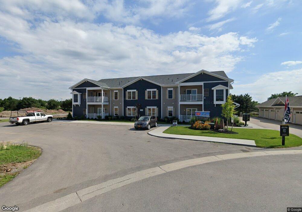
299 Northill Dr Unit A Amherst, NY 14221
East Amherst NeighborhoodEstimated Value: $354,000 - $378,000
2
Beds
2
Baths
1,158
Sq Ft
$315/Sq Ft
Est. Value
About This Home
This home is located at 299 Northill Dr Unit A, Amherst, NY 14221 and is currently estimated at $364,271, approximately $314 per square foot. 299 Northill Dr Unit A is a home located in Erie County with nearby schools including Forest Elementary School, Mill Middle School, and Williamsville South High School.
Ownership History
Date
Name
Owned For
Owner Type
Purchase Details
Closed on
Jun 24, 2022
Sold by
Rasalingam Maithridevi
Bought by
Sayles Robert and Sayles Martha
Current Estimated Value
Home Financials for this Owner
Home Financials are based on the most recent Mortgage that was taken out on this home.
Original Mortgage
$297,350
Outstanding Balance
$282,093
Interest Rate
5.1%
Mortgage Type
New Conventional
Estimated Equity
$82,178
Purchase Details
Closed on
Nov 21, 2019
Sold by
The Marrano Marc Equity Corporation
Bought by
Rasalingam Maithridevi
Create a Home Valuation Report for This Property
The Home Valuation Report is an in-depth analysis detailing your home's value as well as a comparison with similar homes in the area
Home Values in the Area
Average Home Value in this Area
Purchase History
| Date | Buyer | Sale Price | Title Company |
|---|---|---|---|
| Sayles Robert | $313,000 | None Available | |
| Sayles Robert | $313,000 | None Available | |
| Sayles Robert | $313,000 | None Available | |
| Rasalingam Maithridevi | $260,610 | None Available | |
| Rasalingam Maithridevi | $260,610 | None Available | |
| Rasalingam Maithridevi | $260,610 | None Available |
Source: Public Records
Mortgage History
| Date | Status | Borrower | Loan Amount |
|---|---|---|---|
| Open | Sayles Robert | $297,350 | |
| Closed | Sayles Robert | $297,350 |
Source: Public Records
Tax History
| Year | Tax Paid | Tax Assessment Tax Assessment Total Assessment is a certain percentage of the fair market value that is determined by local assessors to be the total taxable value of land and additions on the property. | Land | Improvement |
|---|---|---|---|---|
| 2024 | $4,724 | $223,500 | $46,800 | $176,700 |
| 2023 | $5,157 | $151,000 | $6,327 | $144,673 |
| 2022 | $5,023 | $151,000 | $6,327 | $144,673 |
| 2021 | $5,699 | $194,100 | $6,327 | $187,773 |
| 2020 | $0 | $194,100 | $6,327 | $187,773 |
Source: Public Records
Map
Nearby Homes
- 299 Northill Dr Unit E
- 35 Hampton Hill Dr
- 59 Beckford Ct
- 29 Stonham Way Unit 702
- 37-A Stonham Way Unit 601
- 37 Stonham Way Unit 602
- 37 Stonham Way Unit 603
- 12 Hampton Hill Dr
- 22 Stonham Way Unit 302
- 22 Stonham Way Unit 303
- 22 Stonham Way Unit 301
- 16 Stonham Way Unit 201
- 36 S Woodside Ln
- 5773 Sheridan Dr
- 131 Thamesford Ct
- 47 Stoneledge Ct
- 39 Wickendon Ct
- 122 Hidden Ridge Common
- 29 Gesel Ln
- 315 Bellingham Dr
- 299 Northill Dr Unit C
- 299 Northill Dr Unit C
- 299 Northill Dr
- 299 Northill Dr
- 299 Northill Dr Unit A
- 299 Northill Dr Unit E
- 293 Northill Dr Unit A
- 293 Northill Dr Unit G
- 293 Northill Dr Unit F
- 293 Northill Dr
- 293 Northill Dr
- 293 Northill Dr Unit E
- 275 Northill Dr Unit D
- 301 Northill Dr Unit E
- 301 Northill Dr Unit G
- 301 Northill Dr Unit A
- 301 Northill Dr Unit H
- 301 Northill Dr
- 101 Old Tower Ln
- 95 Old Tower Ln
Your Personal Tour Guide
Ask me questions while you tour the home.