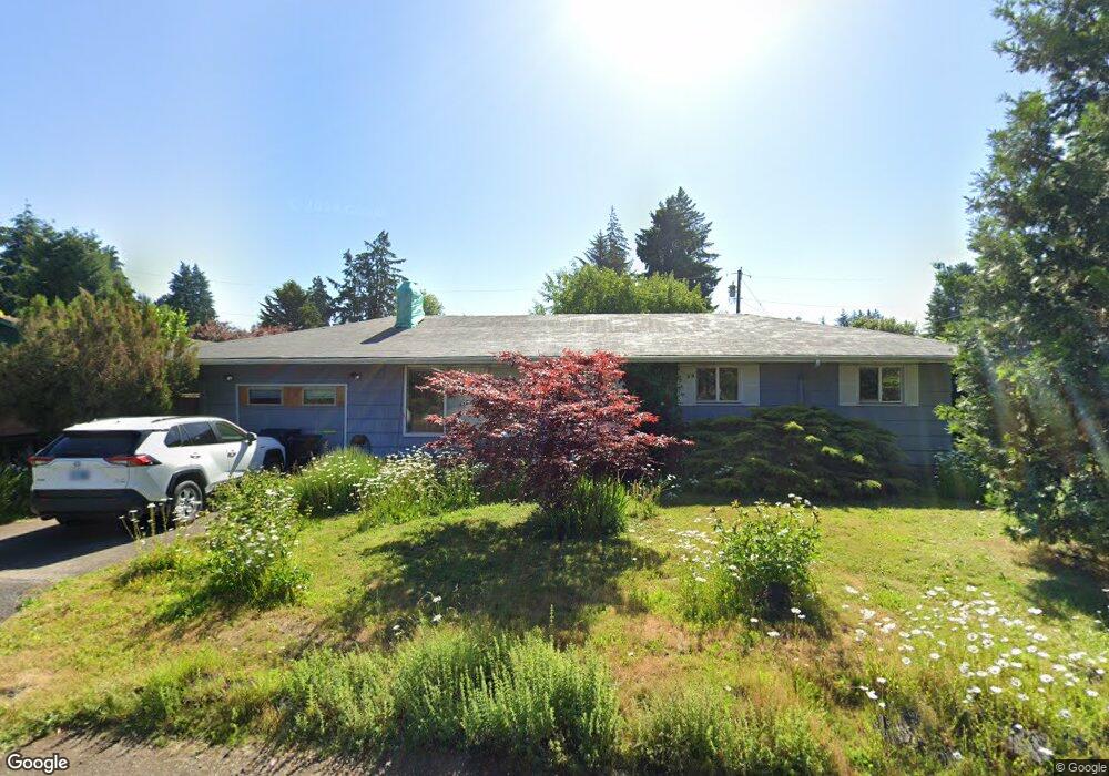
1027 Custer Ct Eugene, OR 97404
River Road NeighborhoodEstimated Value: $364,000 - $410,000
3
Beds
2
Baths
1,296
Sq Ft
$301/Sq Ft
Est. Value
About This Home
This home is located at 1027 Custer Ct, Eugene, OR 97404 and is currently estimated at $390,277, approximately $301 per square foot. 1027 Custer Ct is a home located in Lane County with nearby schools including River Road/El Camino del Río Elementary School, Kelly Middle School, and North Eugene High School.
Ownership History
Date
Name
Owned For
Owner Type
Purchase Details
Closed on
Jul 3, 2007
Sold by
Luttrell Paul R
Bought by
Kundert Melanie J and Luttrell Paul R
Current Estimated Value
Purchase Details
Closed on
Feb 28, 2007
Sold by
Luttrell Anita D
Bought by
Luttrell Paul R
Purchase Details
Closed on
Mar 10, 2006
Sold by
Luttrell Paul R
Bought by
Luttrell Paul R and Luttrell Anita D
Home Financials for this Owner
Home Financials are based on the most recent Mortgage that was taken out on this home.
Original Mortgage
$131,250
Interest Rate
8.52%
Mortgage Type
Fannie Mae Freddie Mac
Purchase Details
Closed on
Jan 13, 2006
Sold by
Parrish Michael C and Parrish Laura T
Bought by
Luttrell Paul
Home Financials for this Owner
Home Financials are based on the most recent Mortgage that was taken out on this home.
Original Mortgage
$131,250
Interest Rate
8.52%
Mortgage Type
Fannie Mae Freddie Mac
Create a Home Valuation Report for This Property
The Home Valuation Report is an in-depth analysis detailing your home's value as well as a comparison with similar homes in the area
Home Values in the Area
Average Home Value in this Area
Purchase History
| Date | Buyer | Sale Price | Title Company |
|---|---|---|---|
| Kundert Melanie J | -- | None Available | |
| Luttrell Paul R | -- | None Available | |
| Luttrell Paul R | -- | Evergreen Land Title Co | |
| Luttrell Paul | $175,000 | Evergreen Land Title Company |
Source: Public Records
Mortgage History
| Date | Status | Borrower | Loan Amount |
|---|---|---|---|
| Previous Owner | Luttrell Paul | $131,250 |
Source: Public Records
Tax History
| Year | Tax Paid | Tax Assessment Tax Assessment Total Assessment is a certain percentage of the fair market value that is determined by local assessors to be the total taxable value of land and additions on the property. | Land | Improvement |
|---|---|---|---|---|
| 2025 | $3,459 | $205,930 | -- | -- |
| 2024 | $3,422 | $199,933 | -- | -- |
| 2023 | $3,422 | $194,110 | $0 | $0 |
| 2022 | $3,218 | $188,457 | $0 | $0 |
| 2021 | $2,993 | $182,968 | $0 | $0 |
| 2020 | $3,014 | $177,639 | $0 | $0 |
| 2019 | $2,908 | $172,466 | $0 | $0 |
| 2018 | $2,712 | $162,566 | $0 | $0 |
| 2017 | $2,574 | $162,566 | $0 | $0 |
| 2016 | $2,434 | $157,831 | $0 | $0 |
| 2015 | $2,343 | $153,234 | $0 | $0 |
| 2014 | $2,328 | $148,771 | $0 | $0 |
Source: Public Records
Map
Nearby Homes
- 820 Park Terrace
- 32 Marion Ln
- 1010 Horn Ln
- 780 Cherry Ave
- 895 Glory Dr
- 1360 Andersen Ln
- 734 Filbert Ave
- 805 River Rd
- 882 Jackies Ln
- 260 Greenleaf Ave
- 172 Oakleigh Ln Unit 513
- 172 Oakleigh Ln Unit 221
- 1010 N Park Ave
- 1633 Zoe Ave
- 1420 Evergreen Dr
- 1314 Dalton Dr
- 0 River Rd Unit 634143722
- 157 Hansen Ln
- 1483 Barton St
- 1487 Barton St
Your Personal Tour Guide
Ask me questions while you tour the home.