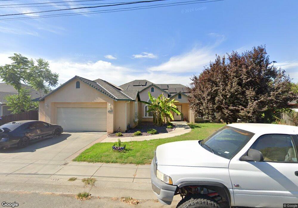
1940 Taft Ave Corning, CA 96021
Estimated Value: $289,000 - $452,000
3
Beds
2
Baths
2,150
Sq Ft
$169/Sq Ft
Est. Value
About This Home
This home is located at 1940 Taft Ave, Corning, CA 96021 and is currently estimated at $363,340, approximately $168 per square foot. 1940 Taft Ave is a home located in Tehama County with nearby schools including West Street Elementary School, Maywood Middle School, and Corning High School.
Ownership History
Date
Name
Owned For
Owner Type
Purchase Details
Closed on
Jul 21, 2005
Sold by
Smith Yvonne K
Bought by
Trevino Rudy and Trevino Bonnie
Current Estimated Value
Purchase Details
Closed on
Oct 17, 2004
Sold by
Eller John D and Eller Nanette
Bought by
Smith Yvonne K
Home Financials for this Owner
Home Financials are based on the most recent Mortgage that was taken out on this home.
Original Mortgage
$43,223
Interest Rate
5.82%
Mortgage Type
Purchase Money Mortgage
Purchase Details
Closed on
Apr 15, 2004
Sold by
Eller John Paul
Bought by
Eller John D and Eller Nanette
Purchase Details
Closed on
Sep 17, 2003
Sold by
Widrig Roy Douglas and Bell Karmen
Bought by
Eller John D and Eller Nanette
Home Financials for this Owner
Home Financials are based on the most recent Mortgage that was taken out on this home.
Original Mortgage
$45,000
Interest Rate
6.17%
Mortgage Type
Purchase Money Mortgage
Create a Home Valuation Report for This Property
The Home Valuation Report is an in-depth analysis detailing your home's value as well as a comparison with similar homes in the area
Purchase History
| Date | Buyer | Sale Price | Title Company |
|---|---|---|---|
| Trevino Rudy | $96,500 | Placer Title Company | |
| Smith Yvonne K | $55,000 | Northern California Title Co | |
| Eller John D | -- | Northern California Title Co | |
| Eller John D | $42,500 | Northern California Title Co |
Source: Public Records
Mortgage History
| Date | Status | Borrower | Loan Amount |
|---|---|---|---|
| Previous Owner | Smith Yvonne K | $43,223 | |
| Previous Owner | Eller John D | $45,000 |
Source: Public Records
Tax History Compared to Growth
Tax History
| Year | Tax Paid | Tax Assessment Tax Assessment Total Assessment is a certain percentage of the fair market value that is determined by local assessors to be the total taxable value of land and additions on the property. | Land | Improvement |
|---|---|---|---|---|
| 2025 | $3,273 | $311,437 | $65,138 | $246,299 |
| 2023 | $3,275 | $311,437 | $65,138 | $246,299 |
| 2022 | $3,294 | $311,437 | $65,138 | $246,299 |
| 2021 | $2,940 | $283,124 | $59,216 | $223,908 |
| 2020 | $2,611 | $246,195 | $51,492 | $194,703 |
| 2019 | $2,433 | $234,471 | $49,040 | $185,431 |
| 2018 | $2,260 | $213,156 | $44,582 | $168,574 |
| 2017 | $2,083 | $193,778 | $40,529 | $153,249 |
| 2016 | $1,886 | $184,550 | $38,599 | $145,951 |
| 2015 | -- | $184,550 | $38,599 | $145,951 |
| 2014 | $1,660 | $160,479 | $33,565 | $126,914 |
Source: Public Records
Map
Nearby Homes
- 1013 Toomes Ave
- 2480 Houghton Ave
- 2018 Donnovan Ave
- 0 Toomes Ave Unit SN25272183
- 0 Toomes Ave Unit SN24222817
- 0 Toomes Ave Unit SN25176211
- 1195 West St
- 1419 Yolo St
- 1980 Colusa St
- 1311 6th Ave
- 1162 5th Ave
- 1456 Fig Ln
- 1568 Link St
- 1216 South St
- 1214 Marin St
- 2097 North St
- 1121 Marin St
- 304 6th St
- 311 6th St
- 1410 4th Ave
- 1918 Taft Ave
- 1896 Taft Ave
- 1846 Taft Ave
- 1900 Grant Ave
- 1903 Taft Ave
- 1958 Taft Ave
- 1910 Grant Ave
- 1914 Grant Ave
- 1909 Taft Ave
- 1826 Taft Ave
- 911 Lincoln Ave
- 1916 Grant Ave
- 1827 Taft Ave
- 1948 Taft Ave
- 1808 Grant Ave
- 1901 Mckinley Ave
- 1909 Mckinley Ave
- 1928 Grant Ave
- 1982 Taft Ave Unit 1
- 1982 Taft Ave